Introduction to Bathymetry
Bathymetry is the study of underwater depth of ocean floors, lakes, rivers, and their respective geological features. It plays a vital role in understanding aquatic ecosystems, as it provides essential information on the underwater landscape, which influences the distribution and behavior of various marine and freshwater species. Accurate bathymetric data aids in mapping these ecosystems and enables researchers to identify habitats, assess biodiversity, and make informed conservation decisions.
The historical roots of bathymetry can be traced back to ancient civilizations that used rudimentary techniques to gauge water depths. Early mariners relied on lead lines, weighted ropes commonly used to measure depths by lowering weights into the water. As our understanding of underwater environments progressed, so did the methods for gathering bathymetric data. The 19th century marked a significant evolution in bathymetric studies as researchers began employing sonar technology, allowing for more precise and comprehensive mapping of ocean floors.
Modern bathymetry leverages advanced technologies such as multi-beam and single-beam sonar, which utilize sound waves to measure depth by emitting signals and recording the time it takes for them to return after striking the seabed. Satellite altimetry has also emerged as a powerful tool, allowing researchers to collect data from outer space with a broader perspective on ocean floor topography. These advancements enable scientists to create detailed three-dimensional models of aquatic environments, facilitating a deeper understanding of the relationships between underwater topography and marine life.
Through the integration of traditional techniques and cutting-edge technologies, bathymetric studies have evolved into a critical field of research. This progression underscores the importance of ongoing exploration and mapping endeavors that contribute to our knowledge of underwater environments and their complex ecosystems, ultimately informing sustainable practices for the protection of aquatic habitats.
The Science Behind Bathymetry
Bathymetry, the study of underwater depths, involves a range of scientific methods and techniques to measure the depth of oceans, lakes, and other water bodies. The fundamental principles of bathymetry combine physics, acoustics, and remote sensing, making it an interdisciplinary field essential for oceanographic research and navigation. One of the primary methods utilized in bathymetry is sonar, which utilizes sound waves to determine the distance between the seabed and a vessel. Through the emission of sound pulses, sonar systems record the time it takes for echoes to return after bouncing off the ocean floor, allowing researchers to calculate depth accurately.
While sonar is widely employed, echo sounding, a more specific form of sonar, is particularly crucial for mapping contours of the seabed. This technique sends a pulse of sound downwards, and the time delay of the return signal provides valuable information about the depth of the water column. Echo sounding can be used in various environments, from shallow lakes to the deep ocean, enabling a comprehensive understanding of underwater topographies.
Furthermore, advancements in technology have led to the development of satellite altimetry, a method that measures the time it takes for a radar signal to travel from a satellite to the ocean surface and back. This technique allows for the large-scale mapping of ocean surface heights, indirectly providing insights into underwater features by analyzing gravity anomalies. Satellite altimetry is particularly advantageous due to its ability to cover vast areas quickly and efficiently, complementing traditional methods.
Each technique contributes to a holistic understanding of bathymetry, aiding researchers in various fields including marine biology, geology, and environmental science. As these scientific methods evolve, they enhance our capability to monitor and manage underwater ecosystems, providing critical data for conservation efforts and maritime activities.
Applications of Bathymetric Data
Bathymetric data plays a critical role across various fields, providing essential information for environmental studies, maritime navigation, resource exploration, and habitat mapping for marine life. The precise understanding of underwater topography enables scientists, researchers, and industry professionals to make informed decisions in these areas, ultimately leading to improved outcomes and sustainable practices.
In environmental studies, bathymetric data is crucial for assessing ecosystem health and understanding sediment transport processes. By analyzing the shape and structure of underwater landscapes, researchers can identify areas vulnerable to erosion or pollution. This information informs conservation efforts and aids in developing strategies to protect aquatic environments, ensuring the preservation of biodiversity.
Maritime navigation is another significant application of bathymetric data. Accurate depth information is vital for safe shipping routes, especially in congested or hazardous waters. With detailed bathymetric maps, vessels can avoid submerged hazards and plan their courses effectively, thereby reducing the risk of maritime accidents. Furthermore, bathymetric surveys are essential for charting new shipping channels, maintaining port infrastructure, and managing marine traffic efficiently.
Resource exploration is perhaps one of the most economically impactful applications of bathymetric data. The oil and gas industries, along with mineral extraction operations, heavily rely on precise depth measurements to locate potential drilling sites. Bathymetric information aids in assessing the seabed’s geological features, which can indicate the presence of valuable resources. Similarly, bathymetric data is crucial for the renewable energy sector, as it helps in selecting suitable locations for offshore wind farms and tidal energy installations.
Lastly, bathymetric data plays a vital role in mapping habitats for marine life. Understanding the underwater topography allows researchers to identify critical habitats, such as coral reefs, seagrass beds, and spawning grounds, which are essential for the reproductive success of various marine species. This data aids in developing effective management and conservation strategies to protect these sensitive ecosystems while promoting sustainable fisheries.
Bathymetry and Marine Ecosystems
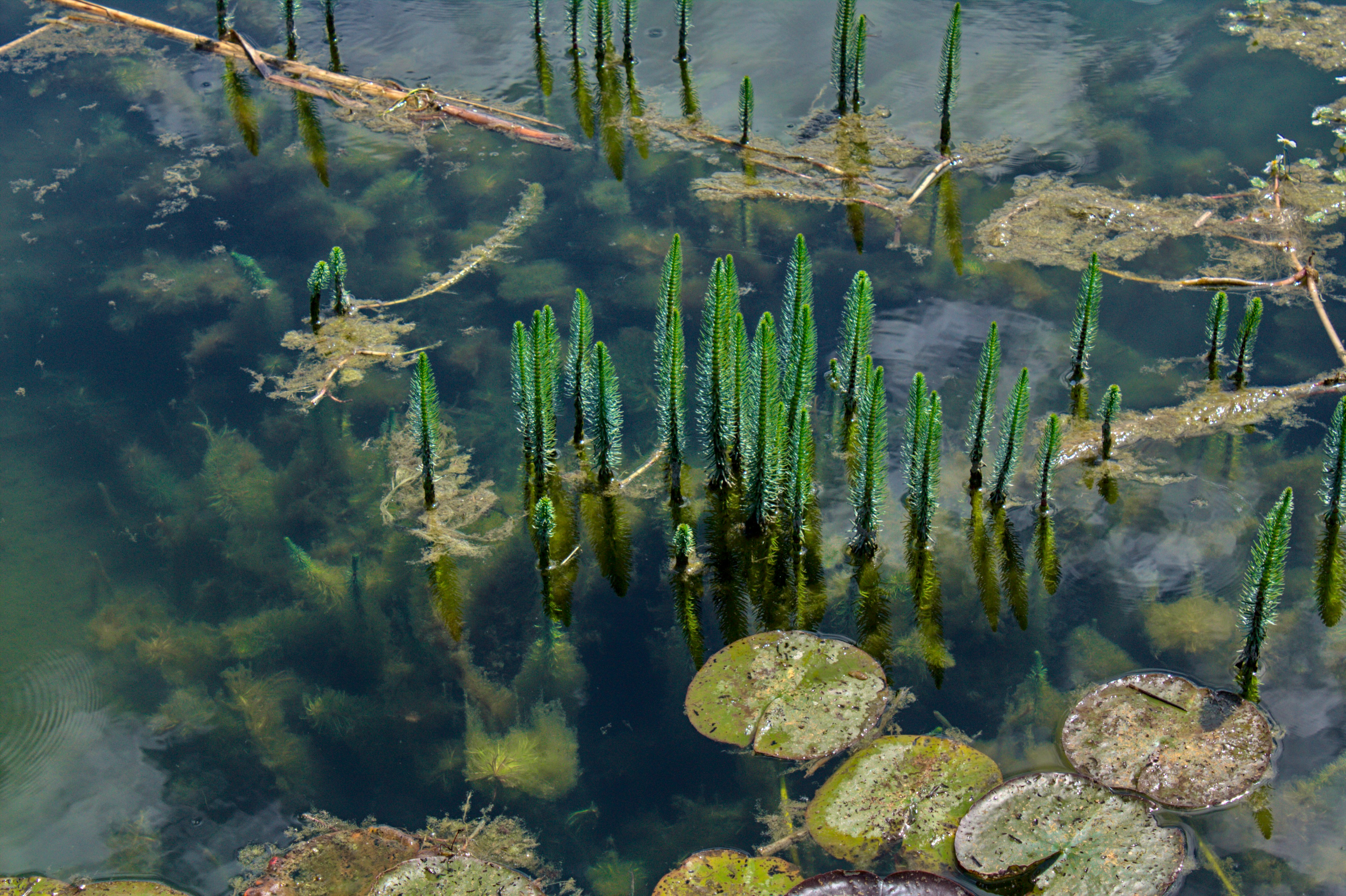
Bathymetry, the study of underwater depth and topography, plays a critical role in shaping marine ecosystems. The characteristics of underwater landscapes significantly influence biodiversity, nutrient distribution, and habitat formation within various aquatic environments. Understanding these relationships is essential for environmental conservation and effective marine resource management.
Different topographical features, such as underwater mountains, valleys, and trenches, create a variety of habitats that support distinct biological communities. For instance, coral reefs thrive in shallow, warm waters where sunlight penetrates, facilitating photosynthesis in symbiotic algae. The complex structures of coral reefs, which rise from the ocean floor, provide shelter and breeding grounds for countless marine species, making these areas biodiversity hotspots. Conversely, the deep-sea trenches represent an entirely different ecosystem, characterized by extreme conditions such as high pressure and low temperatures. Here, specialized organisms have adapted to survive, often relying on chemosynthesis rather than photosynthesis, illustrating how varied bathymetric features lead to diverse ecological niches.
Moreover, the underwater topography influences the distribution of nutrients essential for the survival of marine life. Upwelling zones—where deep waters rise to the surface—are often associated with significant bathymetric features, such as continental shelves or seamounts. These areas are rich in nutrients, promoting plankton blooms that serve as the foundation of marine food webs. As such, the interplay between bathymetry and the availability of resources underscores the importance of these features in maintaining the overall health of marine ecosystems.
In conclusion, the relationship between bathymetry and marine ecosystems is intricate and vital. By understanding how these underwater landscapes shape biodiversity and nutrient abundance, policymakers and conservationists can better protect and manage our oceans and lakes, ensuring the sustainability of these critical environments for future generations.
Technological Advances in Bathymetric Research
The field of bathymetric research has experienced significant advancements in recent years, largely driven by technological innovation. One of the most noteworthy developments is the increased use of autonomous underwater vehicles (AUVs), which have revolutionized how researchers collect data on underwater terrains. These AUVs are capable of operating independently over extended periods, allowing for comprehensive mapping of lakes and oceans with minimal human intervention. Equipped with advanced sensors and GPS systems, AUVs can capture high-resolution bathymetric data that significantly enhances our understanding of underwater landscapes.
Additionally, improved sonar systems have played a vital role in enhancing bathymetric studies. Multibeam and side-scan sonar technologies provide detailed and three-dimensional representations of the seabed, enabling researchers to identify and analyze various underwater features. These sonar systems have drastically increased the accuracy of depth measurements and have been pivotal in uncovering previously unknown aspects of aquatic environments. By employing advanced sonar technologies, scientists can generate detailed maps that reveal the complexities of underwater geology, sedimentation patterns, and even habitat distributions.
The integration of bathymetry with Geographic Information Systems (GIS) has further enhanced research capabilities. By combining bathymetric data with GIS technology, researchers can create powerful visualizations and conduct more sophisticated spatial analyses. This combination facilitates better decision-making regarding marine resource management, habitat conservation, and the assessment of environmental changes. For instance, using GIS to overlay bathymetric data with other environmental datasets enables researchers to study relationships between depth, marine life distribution, and anthropogenic impacts.
In conclusion, the advancements in AUVs, sonar technology, and the integration of bathymetry with GIS reflect a transformative era in underwater research. These innovations improve data accuracy and efficiency while expanding our capacity to understand complex aquatic environments better.
Challenges in Bathymetric Mapping
Bathymetric mapping presents a host of challenges that can significantly complicate the process of charting underwater depths in lakes and oceans. One primary difficulty is the inherent inaccessibility of certain ocean depths, where the pressure is extreme and conditions are unpredictable. Submersible vehicles and autonomous underwater vehicles (AUVs) equipped with sonar technology are often the tools of choice for marine researchers. However, operating these instruments at great depths can be constrained by both technical limitations and environmental factors. For instance, water pressure can impair equipment functionality, making reliable data collection a significant challenge.
Moreover, weather conditions play a critical role in bathymetric surveys. Rough seas, high winds, and inclement weather can hinder data collection, resulting in incomplete or inaccurate bathymetric maps. The variability in ocean conditions can also influence the effectiveness of sonar waves, as rough surface conditions may scatter signals, complicating interpretations of underwater topography. These challenges necessitate careful planning and often limit the timeframe during which data can be effectively gathered.
Another aspect that complicates bathymetric mapping is the diverse and often incomprehensible underwater terrain. This terrain can consist of steep cliffs, underwater volcanoes, and varying sediment types. Accurately depicting these features requires advanced technology and significant expertise, as well as intensive data processing to create reliable maps. Bathymetrists must also account for natural phenomena such as sediment movement and biological activities that can alter underwater landscapes over time. Consequently, adapting to constantly changing environments represents another barrier in producing precise and up-to-date bathymetric datasets. These myriad challenges emphasize the complexity of bathymetric mapping and highlight the need for continued technological innovation and methodological refinement in this critical field of oceanography.
Case Studies in Bathymetry
The exploration of bathymetry has yielded significant insights into both environmental changes and the characteristics of underwater features. One notable case study is the bathymetric survey of Lake Baikal in Siberia, Russia. As the deepest and oldest freshwater lake in the world, Lake Baikal has been the subject of extensive research. Recent bathymetric studies utilizing advanced sonar technology have revealed previously unknown geological formations and contributed to our understanding of sediment accumulation, which is crucial for assessing the ecological health of this unique ecosystem.
Another significant case involves the bathymetric mapping of the Great Barrier Reef in Australia. The reef is not only a UNESCO World Heritage Site but also one of the most biodiverse ecosystems on the planet. Detailed bathymetric data has enabled scientists to monitor the effects of climate change on coral reefs, outlining how shifts in water temperature and salinity are altering marine habitats. This information is vital for conservation efforts, as it allows for the identification of areas that are particularly vulnerable to environmental stressors.
In the realm of oceanographic studies, the bathymetric exploration of the Mariana Trench has provided profound insights into one of the deepest parts of the Earth’s oceans. Through high-resolution bathymetric mapping, researchers have discovered unique underwater thermal vents and other geological structures that contribute to our understanding of plate tectonics and marine biology. Such studies not only enhance our comprehension of oceanographic systems but also highlight the importance of underwater landscapes in global ecological dynamics.
These case studies underscore the importance of bathymetric research in unraveling geological complexities and monitoring environmental changes. By employing sophisticated data collection methods, researchers are developing a better understanding of both freshwater and marine ecosystems, paving the way for informed conservation strategies and sustainable management of these vital resources.
Future Directions in Bathymetric Research
The field of bathymetric research is poised for significant evolution, especially with the advent of advanced technologies such as machine learning and artificial intelligence (AI). As the demand for accurate underwater mapping increases, these technologies can aid in processing vast amounts of data, allowing researchers to efficiently analyze and interpret complex bathymetric datasets. By automating detection and classification of various features, AI algorithms reduce human error and enhance the precision of underwater surveys. Furthermore, machine learning can uncover patterns within the data that may not be readily apparent through traditional analytical methods, thus providing deeper insights into the dynamics of aquatic environments.
Another crucial aspect of future bathymetric research involves fostering global collaborations among researchers, governments, and maritime organizations. Many bodies of water, including lakes and oceans, transcend national borders, highlighting the need for shared data and collective efforts in comprehensive mapping initiatives. Collaborative projects ensure that bathymetric data is not only accurate but also accessible to a wider audience, enabling scientists to address global ecological challenges such as climate change and habitat loss more effectively. This cooperation could lead to the establishment of standardized protocols for data collection and sharing, enhancing the overall quality and applicability of bathymetric research across various disciplines.
Moreover, the relationship between bathymetric studies and climate change mitigation is becoming increasingly evident. As rising sea levels and ocean acidification continue to threaten marine ecosystems, detailed bathymetric mapping can provide critical information on the underwater landscape, revealing areas at risk and guiding conservation efforts. Identifying and monitoring habitats affected by climate change can inform policymakers and the public alike, facilitating targeted strategies aimed at preserving vulnerable species and ecosystem services. In this context, continued advancements in bathymetric technology and collaborative research efforts are essential for understanding and combating the impact of climate change on our oceans and lakes.
Conclusion
In summary, the exploration of bathymetry plays a crucial role in enhancing our understanding of the underwater depths of lakes and oceans. Throughout this discussion, we have delved into various aspects of bathymetric mapping, highlighting its significance in oceanography, environmental management, and resource exploration. The techniques employed in bathymetry, such as sonar technology and satellite altimetry, have allowed researchers to create detailed topographical maps of the seabed, revealing features that are critical to various scientific inquiries.
Additionally, we have examined how bathymetric data is invaluable for understanding ecological systems, including the habitats of various marine species and the dynamics of sediment transport. Such knowledge is vital as it influences conservation efforts, maritime navigation, and even climate change studies. By unveiling the complexities of underwater terrains, bathymetry provides insights that can help shape policies for sustainable management of our aquatic resources.
Moreover, as technology continues to advance, the field of bathymetry is poised for further developments. Innovative methods, including unmanned underwater vehicles and enhanced data collection algorithms, promise to make bathymetric surveys more efficient and precise. Continued investment in research and development will be essential to push the boundaries of our understanding and application of bathymetric data, ultimately allowing us to better protect and utilize our planet’s water bodies.
In conclusion, the importance of bathymetry cannot be overstated in our pursuit of knowledge about underwater landscapes and ecosystems. As we deepen our exploration of these aquatic environments, a clear commitment to research and embracing technological advancements will be imperative for sustainable interaction with our oceans and lakes.